Current position of the Moon
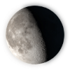
Today on Monday, July 06, 2026, 17:51 UTC time The moon coordinate on the world map is 3°0'N, 158°13'N, today the moon is 21.08 days old, the moon phase is Last Quarter and the illumination of the moon is 61.3%.

UTC: Monday, July 06, 2026,17:51:25
How does the moon light map work?
- On the map, the moon moves from right to left as it moves across the sky.
- There are red dots on the map, which represent the moon's path on this particular day.
- The time on the map is in the UTC Time Zone.
- If you find either +1 or -1 in the time grid, it represents either tomorrow or yesterday.
- The time grids on the map keep changing based on the moon timeline, since they represent the time of moon position on the moon.
- The moon icon on the map changes according to the moon phase.
- The light you see on the map is the light of moonlight, not the sun.
Forecast Moon Coordinates on Map
| Time | CoordinatesLatitude, Longitude | Illumination | DistanceFrom Earth |
|---|---|---|---|
| Mon 00:00 | 61°30'N, 165°6'S | 68.75% | 383,429.61 km |
| Mon 02:00 | 61°32'N, 166°55'S | 67.94% | 383,029.41 km |
| Mon 04:00 | 61°34'N, 168°44'S | 67.12% | 382,629.21 km |
| Mon 06:00 | 61°36'N, 170°34'S | 66.3% | 382,229.15 km |
| Mon 08:00 | 61°38'N, 172°23'S | 65.47% | 381,829.40 km |
| Mon 10:00 | 61°39'N, 174°12'S | 64.64% | 381,430.09 km |
| Mon 12:00 | 61°41'N, 176°1'S | 63.8% | 381,031.39 km |
| Mon 14:00 | 61°43'N, 177°51'S | 62.95% | 380,633.43 km |
| Mon 16:00 | 61°45'N, 179°40'S | 62.1% | 380,236.39 km |
| Mon 18:00 | 61°47'N, 158°59'S | 61.24% | 379,840.40 km |
| Mon 20:00 | 61°49'N, 160°48'S | 60.38% | 379,445.62 km |
| Mon 22:00 | 61°50'N, 162°37'S | 59.51% | 379,052.21 km |
Moon's zenith coordinates
Latitude
3°0'N
3.0124
Longitude
158°13'N
158.228
The closest locations to the moon coordinates
Those below are the closest locations to the moon on the earth map (Nearest locations on the zenith position to the moon in the sky). So the distance below isn't the distance between a location on earth and the moon. Instead, it's the distance between the moon's coordinates on earth and the closest locations to the moon.
| Location | DistanceFrom Moon coordinates on The Map | Degree | Direction |
|---|---|---|---|
| Ettal Village | 365.70 km | 298.84289958404° | West-Northwest |
| Yaren District | 648.86 km | 112.27928807381° | East Southeast |
| Honiara | 868.11 km | 172.15001580976° | South |
| Majuro | 947.92 km | 72.701286642372° | East Northeast |
| South Tarawa | 1,023.70 km | 96.248267718023° | East |
| Hagåtña | 1,170.61 km | 308.17263395037° | Northwest |
| Aitape | 1,175.96 km | 248.831134569° | West Southwest |
| Lamap | 1,494.11 km | 153.96407909378° | South Southeast |
| Funafuti | 1,649.90 km | 118.89108814527° | East Southeast |
| Airai | 1,655.67 km | 280.45322451953° | West |